Pedestrian and Bicycle Facilities
The City continues to develop a comprehensive system of pedestrian and bicycle facilities as part of the Transportation Element of the Comprehensive Plan. Projects are directed at improving conformity to standards, connectivity, and signage for non-motorized facilities throughout the Island.
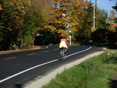
The Pedestrian and Bicycle Facilities Plan, originally approved in 1996 and updated in 2010, guides investments and other actions relating to Mercer Island’s pedestrian and bicycle facilities such as trails, crosswalks, bike lanes, and sidewalks. The plan includes a complete list of projects and improvements to be constructed as budget allows, based on Council prioritization and approval. One example of this work is the multi-year road shoulder upgrade program covering almost the entire perimeter of Mercer Island, providing space for bicycles and pedestrians on the East, West, and North Mercer Way streets (click for map).
The majority of target projects are generally identified in the current Pedestrian and Bicycle Facilities Plan, however, some new or emerging projects can be added as part of the annual Transportation Improvement Program (TIP) update and approval process.
Current/Upcoming Projects
- 76th Avenue SE Mid-Block Crossing (SE 27th Street)
- East Mercer Way Shoulders - Phase 11 (SE 79th Street to 8400 Block)
- North Mercer Way Sidewalk (Fortuna to SE 35th Street)
For more information on getting around Mercer Island by bike, foot, or transit, visit our Getting Around page, which includes our Mercer Island Bike Route Map, or view this 2016 map from King County Metro's Mercer Island In Motion campaign (note: some bus routes have since been terminated).
Learn more about Road Safety Best Practices
Learn more about local MI cycling group Neighbors in Motion

